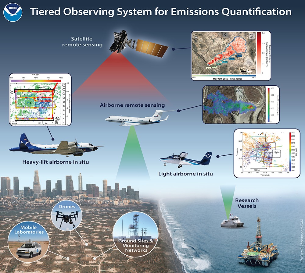
AIrborne and Remote sensing Methane and Air Pollutant Surveys (AiRMAPS) is a series of studies led by NOAA Oceanic and Atmospheric Research (OAR) and NOAA National Environmental Satellite, Data, and Information Service (NESDIS) to provide comprehensive and quantitative top-down emissions data for methane, other greenhouse gases, and major air pollutants from oil and gas production basins, and selected urban and agricultural areas.